Cyclone Ditwah is approaching Tamil Nadu-Puducherry-South Andhra coast with heavy rain, strong winds and rough sea conditions. TN has red and orange alerts, AP expects very heavy rain, and Puducherry has urged residents to stay indoors.
Cyclone Ditwah is moving closer to the Tamil Nadu-Puducherry-South Andhra Pradesh coast, bringing the risk of very heavy rain, strong winds, and rough sea conditions. Multiple districts are under red and orange alerts, fishermen have been pulled away from the sea, and the National Disaster Response Force (NDRF) has been deployed across several areas as the storm slowly intensifies. Officials say the exact landfall time will depend on the cyclone’s shifting track over the next 24 hours.

The cyclonic system developed from a deep depression near the Sri Lankan coast and is now being treated as a cyclonic storm. For now, the India Meteorological Department (IMD) does not expect it to grow into a severe cyclone, but it is still strong enough to bring dangerous weather across southern India.
Cyclone track and wind strength
According to the IMD, winds near the core of Cyclone Ditwah may reach 60-80 kmph, with gusts up to 90 kmph. The outer bands could produce winds of 35–45 kmph, gusting to 55 kmph. Similar conditions may also appear over parts of the Arabian Sea near Kerala, Lakshadweep, and the Maldives.
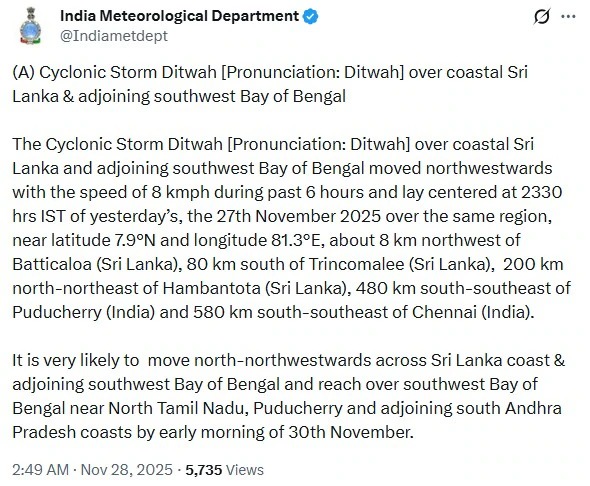
The IMD said that the system is currently over the Southwest Bay of Bengal, close to the Sri Lankan coast. As of early Friday morning, the storm was located:
Related Articles

- 50 km south of Trincomalee (Sri Lanka)
- 70 km northwest of Batticaloa
- 220 km north of Hambantota
- 460 km south-southeast of Puducherry
- 560 km south-southeast of Chennai
The storm moved at 10 kmph in the last six hours. It is likely to continue travelling north-northwest along the Sri Lankan coast, re-enter the Bay of Bengal, and then approach the Tamil Nadu-Puducherry-South Andhra coast between the evening of November 29 and the morning of November 30.
Red and orange alerts in Tamil Nadu
Tamil Nadu has issued a red alert for:
- Thanjavur
- Tiruvarur
- Nagapattinam
- Mayiladuthurai
These districts may receive more than 20 cm of rain in 24 hours. An orange alert has been issued for nearby districts such as:
- Chennai
- Tiruvallur
- Kancheepuram
- Ranipet
- Chengalpattu
Chief Minister MK Stalin held a meeting with the state’s disaster management authority to check preparedness. He directed all departments to coordinate closely and ensure relief teams are ready. Authorities said the northeast monsoon has brought about 35 cm of rain so far, slightly more than normal, although Chennai remains 31% below its usual rainfall.
In the last 24 hours, scattered rain was seen in Tamil Nadu. Thangachimadam recorded 3 cm of rain, while Puducherry and Karaikal saw very little.
The cyclone’s name, Ditwah, was suggested by Yemen. It is likely inspired by the Detwah Lagoon located on Socotra Island.
Warnings and alerts in Andhra Pradesh
The Andhra Pradesh State Disaster Management Authority (APSDMA) confirmed that the deep depression near Sri Lanka strengthened into Cyclone Ditwah and is now moving towards the state. Heavy rain and strong winds are expected across:
- South Coastal Andhra Pradesh
- Rayalaseema
Districts expected to receive heavy to very heavy rain include:
- Chittoor
- Tirupati
- Nellore
- Prakasam
- YSR Kadapa
- Annamayya
- Sri Sathya Sai
The storm is expected to move close to the north Tamil Nadu-Puducherry-south Andhra stretch between November 29 and 30.
Alerts and instructions for Puducherry
Puducherry is under an orange alert from November 28 to December 1 due to the impact of Cyclone Ditwah. The administration issued several safety warnings:
- Residents should avoid stepping out unless absolutely necessary.
- People should not take shelter under trees, lamp posts, or weak buildings.
- Parents should keep children away from open spaces during strong winds or heavy rain.
Emergency help can be reached through: 1077, 1070, 112
Disaster Management Authority WhatsApp helpline: 94889 81070
Sri Lanka faces heavy damage, deaths and floods
While India prepares for the cyclone, Sri Lanka is already experiencing the worst phase of the weather linked to the same system. The country has seen three days of continuous rain, which triggered:
- Severe floods
- Landslides
- Road collapses
- Transport shutdowns
Sri Lankan officials confirmed that 47 people have died so far. Schools and institutions are closed, and seven districts are under a red alert. The Sri Lankan Air Force has been deployed for rescue operations.
Train services have been reduced, and many flights may be diverted to Thiruvananthapuram or Cochin due to poor visibility and storms.
Officials say the flooding is linked to the deep depression near Sri Lanka, the same weather system that eventually developed into Cyclone Ditwah over the Bay of Bengal.
NDRF teams deployed across Tamil Nadu and Puducherry
In response to requests from the Tamil Nadu and Puducherry disaster management authorities, the National Disaster Response Force (NDRF) has deployed eight teams across the region. Details of deployment:
- Puducherry: 2 teams (60 personnel)
- Thanjavur: 1 team
- Nagapattinam: 1 team
- Mayiladuthurai: 1 team
- Pudukkottai: 1 team
- Cuddalore: 1 team
- Tiruvarur: 1 team
- Each team has 30 trained members.
The deployment also includes the Search Dog Unit, which has four trained dogs:
- Rani
- Mickey
- Laika
- Rambo
These dogs help rescuers find trapped victims during disasters, especially in collapsed buildings or debris-covered areas.
IMD updates and what to expect next
The IMD said that Cyclone Ditwah is intensifying slowly, but there is no current forecast for it to upgrade into a severe cyclonic storm. Still, the rainfall may be very heavy, and the storm will bring unsafe sea conditions. The biggest concern remains:
- Heavy to very heavy rain in Tamil Nadu, Puducherry, and Andhra Pradesh
- Rough seas, making fishing unsafe for the next five days
- Falling trees or damage to weak structures due to wind
Flooding in low-lying areas
A clearer landfall prediction will become possible once the cyclone moves away from the Sri Lankan coast into open sea.
Cyclone Ditwah is moving steadily toward the Tamil Nadu-Puducherry-South Andhra coast, bringing warnings, alerts, and large-scale preparation. With NDRF teams on the ground, red and orange alerts issued, and rescue forces active in Sri Lanka, authorities have asked people to stay cautious, stay indoors, and follow all safety instructions. Over the next 24 hours, the storm’s track will determine how strong the impact will be along the Indian coast.
(With inputs from agencies)